Can you say geospatial: Find your home site 86 years ago
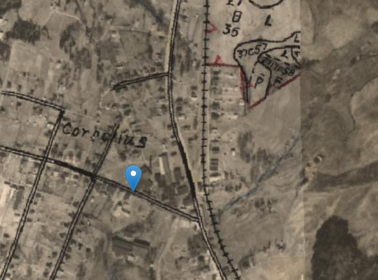
21348 Catawba in 1938
Feb. 12. By Dave Yochum. Have you ever wondered what your property looked like from the air 30 years ago? Seventy-two years ago? How about 85 years ago? Mecklenburg County Geospatial Information Services (GIS) is starting 2024 with a Historical Aerial Photo Viewer that lets you zoom into a specific location and view changes over time.
It starts out in 1938, then hops to 1951. You can see how much farmland there was, especially west of I-77 as well as up and down West Catawba, Bethel Church and Jetton.
Step back in time
Historical aerial photography shows roads then—and now.
“Residents can take a step back in time,” said Jia Wei, GIS director.
Users can see a property as it was in 1938 or 2023, side by side or one year at a time. The year control is a slider tool at the bottom of the screen. There are also layers for the map showing roads and the tree canopy in 2023, 2016, 2012, 2008 and 2001.
Try the time machine
The website is aptly named: timemachine.mcmap.org
Example
For example, you can view the top of your house in vivid detail now, vs. let’s say 2009, or contemplate the pasture that was there in 1938. (That’s not the case for homes near downtown, many of which pre-date 1938.)
One of the most dramatic changes we could think of has occurred at 21348 Catawba Ave.—site of the Cain Center for the Arts.
—The screenshot at the top of this story is the aerial view of 21348 Catawba from 1938.
This picture is from 2002. The former Farmer’s Supply building is still there, while the Police Station is nearing completion. Note the red clay surrounding it; Town Hall is directly across Catawba.
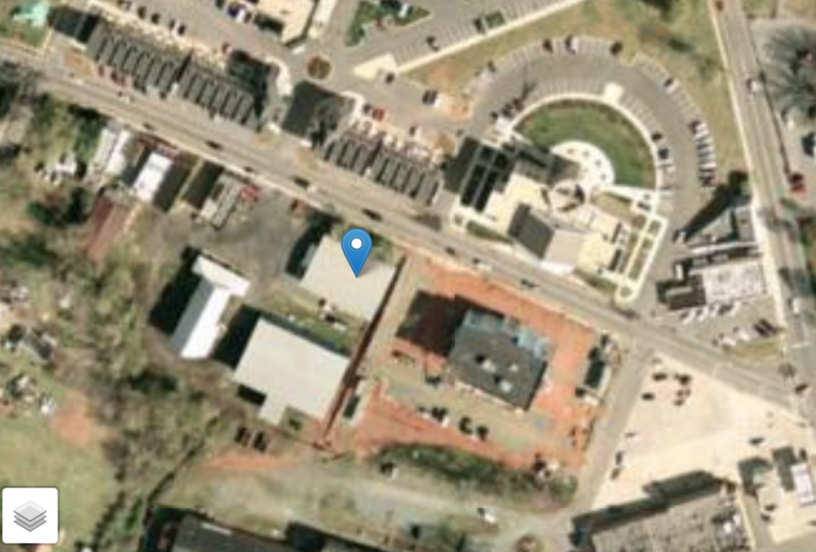
Blue icon marks the spot of the future Cain Center
This picture is from November of 2023.
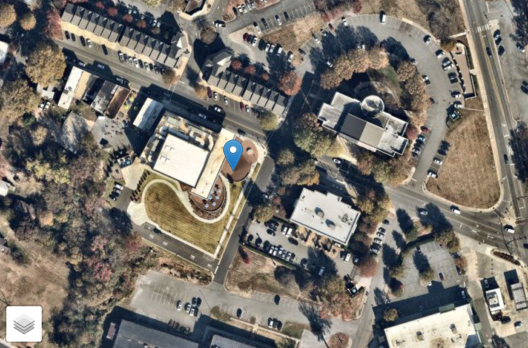
Blue icon marks the exact spot of the new Cain Center
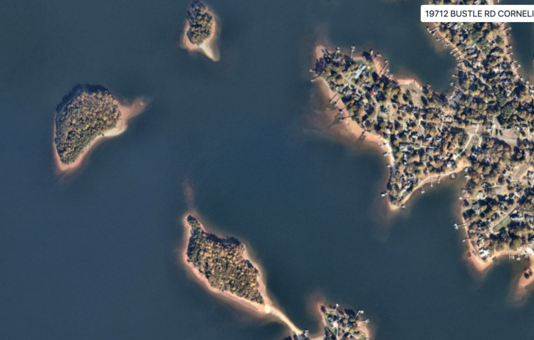
We also compared the lake near Bustle and Shearwater now, vs. 1951:
Now
The Sandbar, Shearwater, Bethel Church/Staghorn
1951
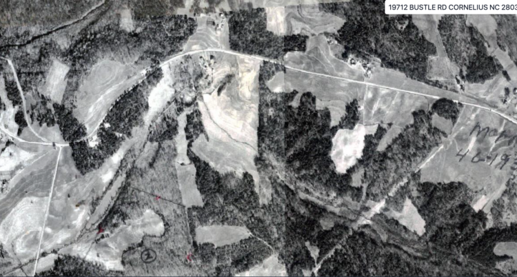
Same location before there was a Lake Norman