Prepare for Irma Monday, Tuesday
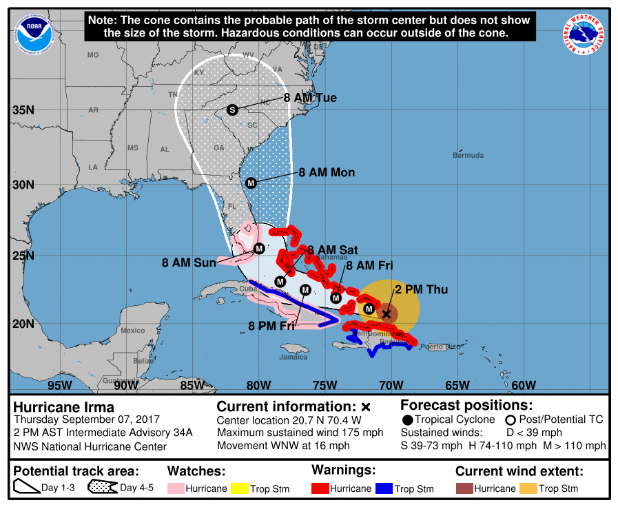
Gov. Roy Cooper has declared a State of Emergency for all 100 counties in North Carolina as Hurricane Irma prepares to bear down on the Florida Keys. How it tracks north is unclear, but it’s certain to track into North Carolina.
If it leans toward us, the Charlotte region will be in for fierce weather late Monday and into Tuesday. Winds could be as high as 60 mph. The National Weather Service forecasts a 100 percent chance of heavy rains here Monday evening, heavy rain into Tuesday and clearing Wednesday.
Sunday will be sunny, with a high near 72. The rains will commence Monday, according to the weather service. Downed trees could affect electrical power throughout our region. There were more than 700,000 power outages reported when Hurricane Hugo hit the Carolinas in 1989.
Here are some pointers in the event of a major hit:
Be Prepared. Develop a plan in advance to ensure that every family member knows what to do, who to call and where to go during an emergency.
Identify your risk. What are the hazards where you live or work? Does your neighborhood flood?
Know the terms. A WATCH means severe weather is possible. A WARNING means severe weather is occurring; take shelter immediately.
Maintain an emergency supply kit both at home and in the car. These kits should include a battery-powered or hand-crank radio.
Secure or bring inside all loose outdoor objects.
Charge your cell phone and other electronic devices.
Think ahead. Power may go out, so ice may be helpful. Put gas in your car.