SnOMG’26 Take Two: Live Updates
The sequel no one asked for is back by unpopular demand. SnOMG’26 is once again your home for updates on all the news related to the winter storm. Got a news tip to share such as power outages, road conditions, snow pictures and more? Contact us at [email protected]
Monday, Feb. 2
5:11 p.m. – Monday and Tuesday garbage collection will take place tomorrow and customers are asked to put cans in the road by 9 a.m. Crews will be working late into the day and unsafe roads may not be serviced. The town made no mention of the rest of the week so the assumption is that trash will be picked up on the normal daily schedule Wednesday through Friday.
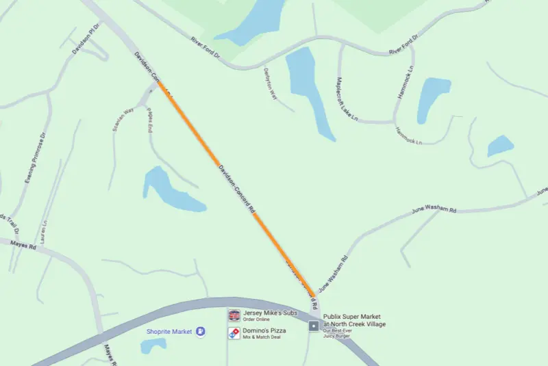
2:44 p.m. – Davidson-Concord Road has reopened between Scanlan Way and June Washam Road.
2:17 p.m. – CMS is closed tomorrow.
After closely monitoring weather conditions and in coordination with local and state officials, all CMS district, school, and work locations will be closed on Tuesday, Feb. 3, 2026. This includes the cancellation of all school activities and programs, including Before-School Enrichment Programs (BSEP) and After-School Enrichment Programs (ASEP), as well as Community Use of Schools. Because this instructional day is waived by the Superintendent, we will not use a designated make-up instructional day on the 2025-26 academic calendar.
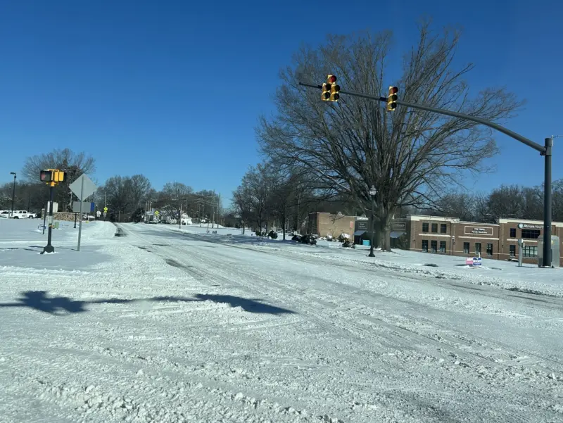
1:28 p.m. – Avoid Jetton Road extension from Publix to the stop sign at One Norman Boulevard—regardless of two- or four-wheel drive. The shade from the trees and buildings has kept the snow/ice from melting and large patches have refrozen in multiple areas. Public works is aware of the situation and has added it to its to-do list.
12:14 p.m. – Davidson-Concord Road between Scanlan Way and June Washam Road is currently closed in both directions due to ice on the roadway. Town of Davidson Public Works is currently treating the road.
11:20 a.m. – Correction to an earlier post. The Board of Commissioners meeting will not be held tonight. The agenda included time sensitive committee and board assignments and those will be handled on Thursday as part of the board’s annual budget meeting at the Cain Center. The remainder of tonight’s agenda will be moved to a future meeting and communicated at a later date.
8:37 a.m. – The Board of Commissioners meeting is on tonight despite Town Hall being closed due to weather. The meeting is open to the public and streamed online on Facebook and on the town website. Agenda is here.
9:35 a.m. – CATS micro service will begin at noon today and end at 6 p.m. The 77X commuter bus is still suspended. Regular bus and blue line service will start at noon and end at midnight. Blue line trains are currently running without passengers to clear ice and snow.
8:48 a.m. – Public works will continue clearing roads today and look to get a big assist from the sunny skies and high of 40 degrees.
8:42 a.m – Reminder that Duke has asked customers to reduce power usage this morning to alleviate demand on its grid and reduce the chance of outages amid record load due to ongoing low temperatures.
8:17 a.m. – Happy Groundhog Day? Puxatawney Phil saw his shadow this morning, calling for six more weeks of winter.
8:03 a.m. – Town hall is closed today. No decision yet on tonight’s Town Board meeting.
7:35 a.m. – Journal entry: it’s been 85 days since The Wintering. Snack supplies are dangerously low. The tundra is still frozen. My shovel has disappeared. We haven’t seen the children in days. More updates soon.
—Jon
Sunday, Feb. 1
5:19 p.m. – There will be no garbage collection tomorrow. Stay with us this sounds like the Who’s on First sketch.
With the delay last week and snow yesterday, WastePro was unable pick up last Friday on Saturday. Last Friday is being skipped.
Pickup tomorrow is canceled. Monday will be picked up on Tuesday. After that officials are requesting that you wheel your trash and recycling to the curb on your respective day and it will be picked up as soon as possible.
Due to delays and the skipped day, WastePro will collect overflow bags left near trash cans.
3:45 p.m. – CMS is closed tomorrow—no surprise—but the last time CMS held a full day of classes was Jan. 23.
3:01 p.m. – Update on CATS service: Bus and blue line service will start tomorrow at noon and end at midnight. Express Bus and Gold Line remain suspended.
2:32 p.m. – One aspect of living in a small(ish) town is appreciating the work of people trying to help instead of complaining about what hasn’t been done. The public works staff has been working the roads for four straight days. If you run into them say thanks, or if you see them drive by smile and wave. They’re working as hard as they can to clear one of the worst winter storms in recorded history.
–Jon
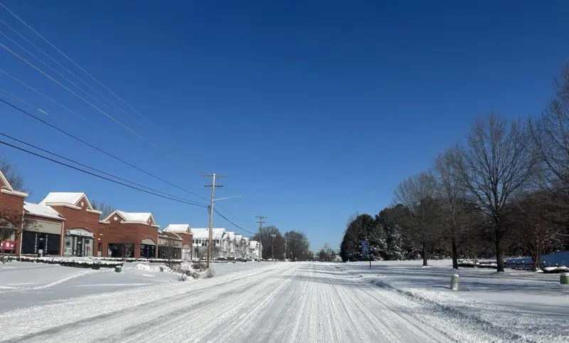
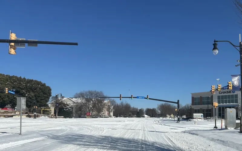
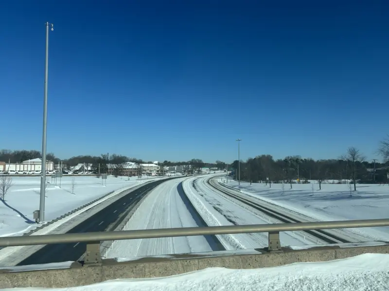
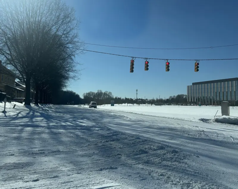
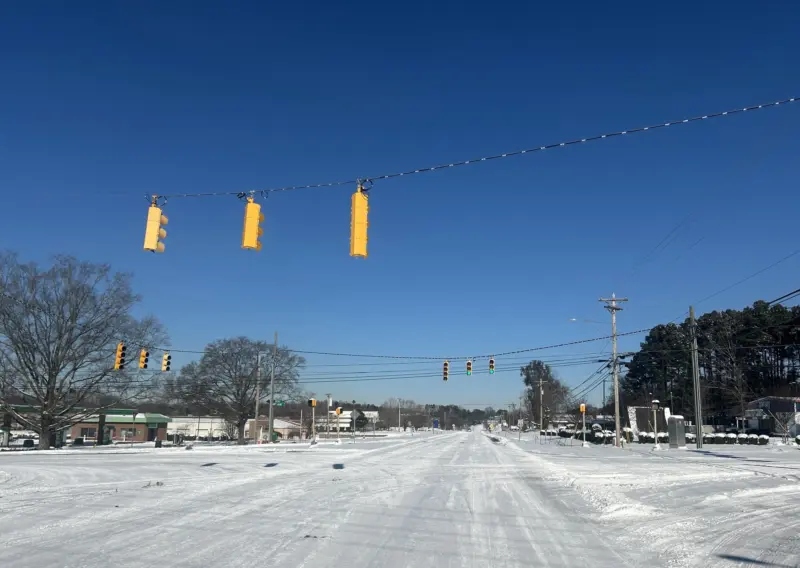
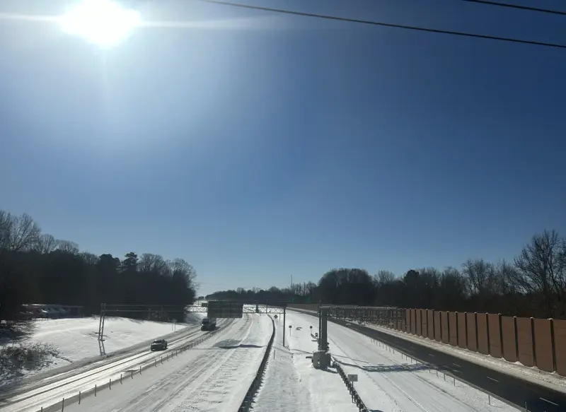
2:04 p.m. – Current road conditions on the south side of town.
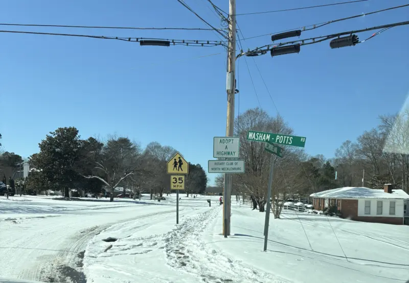
Washam Potts near JV Washam
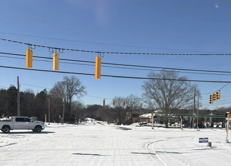
Statesville and Westmoreland
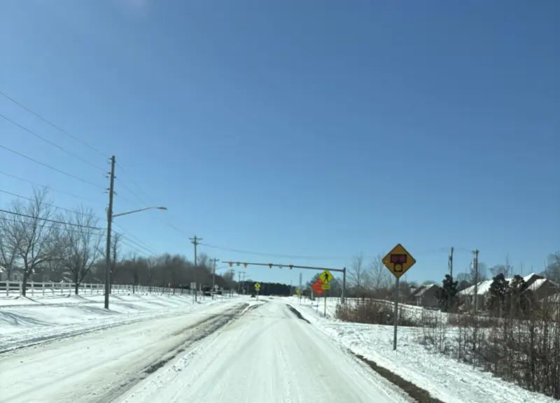
Westmoreland approaching West Catawba
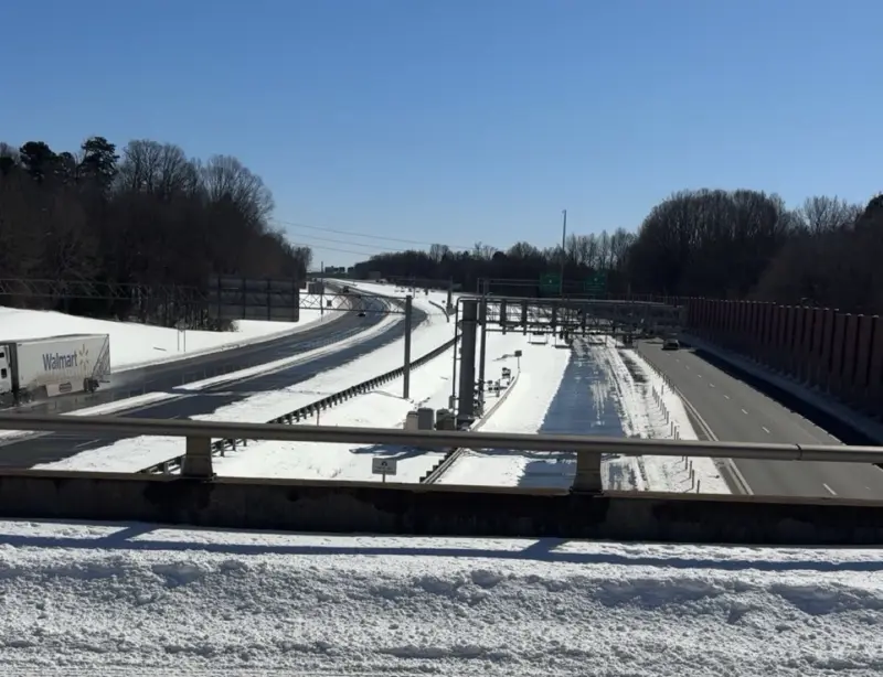
I-77 looking south at mile marker 27
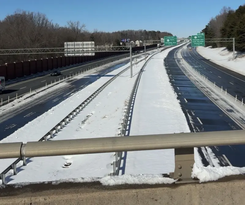
I-77 looking north at mile marker 27
Extremely cold temperatures – 10 to 20 degrees below normal – are driving unusually high energy demand across the East Coast, including the Carolinas. Duke Energy is asking all Carolinas customers to voluntarily reduce their energy use from 4-10 a.m. on Monday, Feb. 2, to help lessen the energy demand on the grid and reduce the potential of temporary power outages.
Customers can help ease strain on the grid by taking the following steps:
• Reduce your thermostat to the lowest comfortable setting.
• Avoid using major appliances such as washing machines, clothes dryers and dishwashers between 4 a.m. and 10 a.m.
• Turn off any unnecessary devices, unused plug-ins and lights.
• Electric vehicle owners: Charge midday, when demand is lower.“We know it’s inconvenient to reduce electric use, but it makes a real difference.” said Gerald Wilson, Duke Energy vice president of grid operations. “We are taking every step to meet our customers energy needs, including maximizing our generation and purchasing power and working with large commercial and industrial customers who have demand response programs. We appreciate our customers’ cooperation, patience and understanding as we work to maintain reliable service across the Carolinas.”
None of the three energy providers in Cornelius currently show any outages on their online maps.
1:17 p.m. – Sledding report from the group of tweens I just passed while walking down the street: “It’s so dope right now.”
12:55 p.m. – Plows have begun clearing neighborhood roads.
Interested in learning about how much better the town is at clearing winter weather compared to a few years ago? Of course you are. Here’s our story from earlier this week.
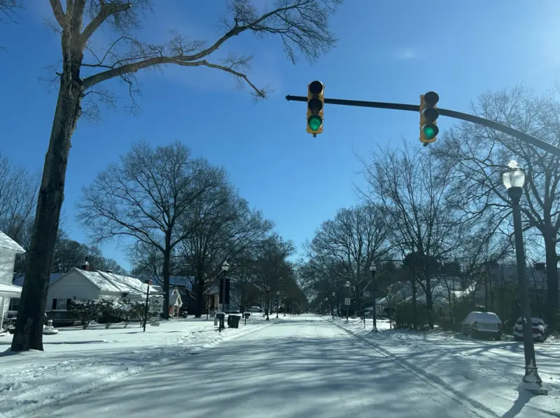
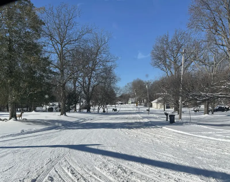
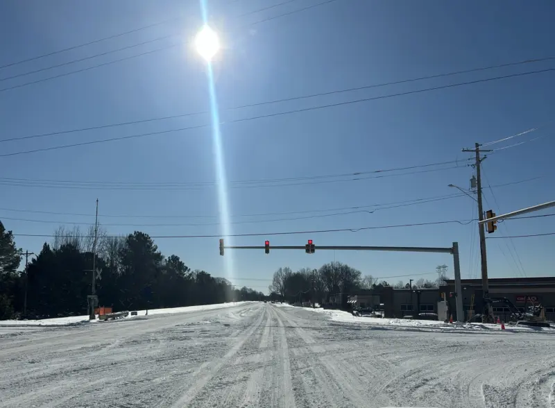
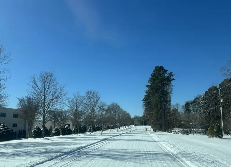
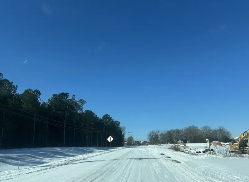
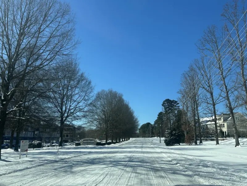
11:10 a.m. – (updated with all images) There’s a reason why town officials are asking people to stay home. Roads are plowed but nowhere near clear. This morning I saw two Cherokees sliding down West Catawba. The snow is plowed and packed on main roads but you can see areas of ice that formed overnight.
If you have four wheel drive and experience driving in snow you’ll probably be ok at greatly reduced speeds. Anything two wheel drive is going to be sliding around.
All photos were taken from a four wheel drive truck, which still spun out twice while pulling into gas stations to upload pictures.
West Catawba near Robbins Park
West Catawba and Jetton
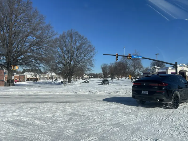
West Catawba and Torrence Chapel
West Catawba near Chick-Fil-A
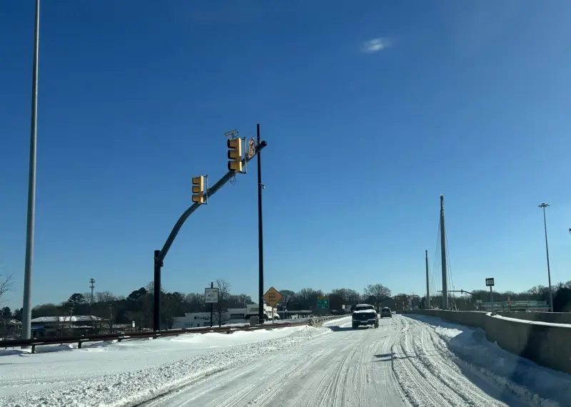
Exit 28
I-77 North from Exit 28
Catawba heading east
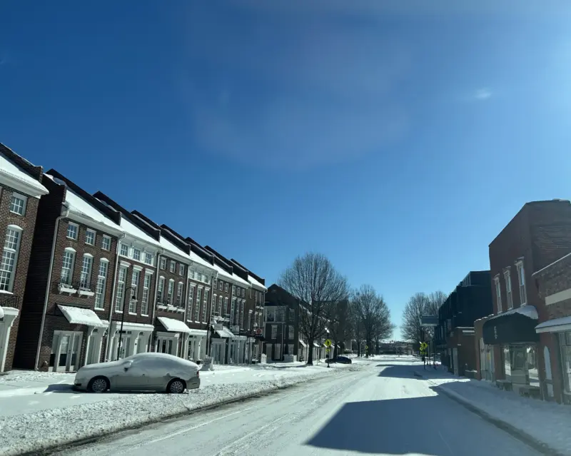
Downtown Cornelius
Catawba and Main
North on Main near Antiquity
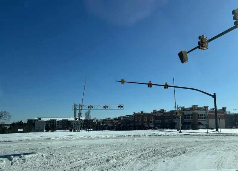
Washam Potts
Bailey and Old Statesville
Bailey heading East
Bailey and Statesville
Statesville and Westmoreland
I-77 looking south from Westmoreland
Westmoreland approaching West Catawba
West Catawba near Kenton Place
9:53 a.m. – CATS just announced it has suspended all services and expects to resume operations tomorrow.
9:51 a.m. – WCNC’s graphic this morning shows snowfall totals in surrounding towns. Cornelius isn’t listed but from what we’ve seen on socials we fluctuated between nine and 12 inches.
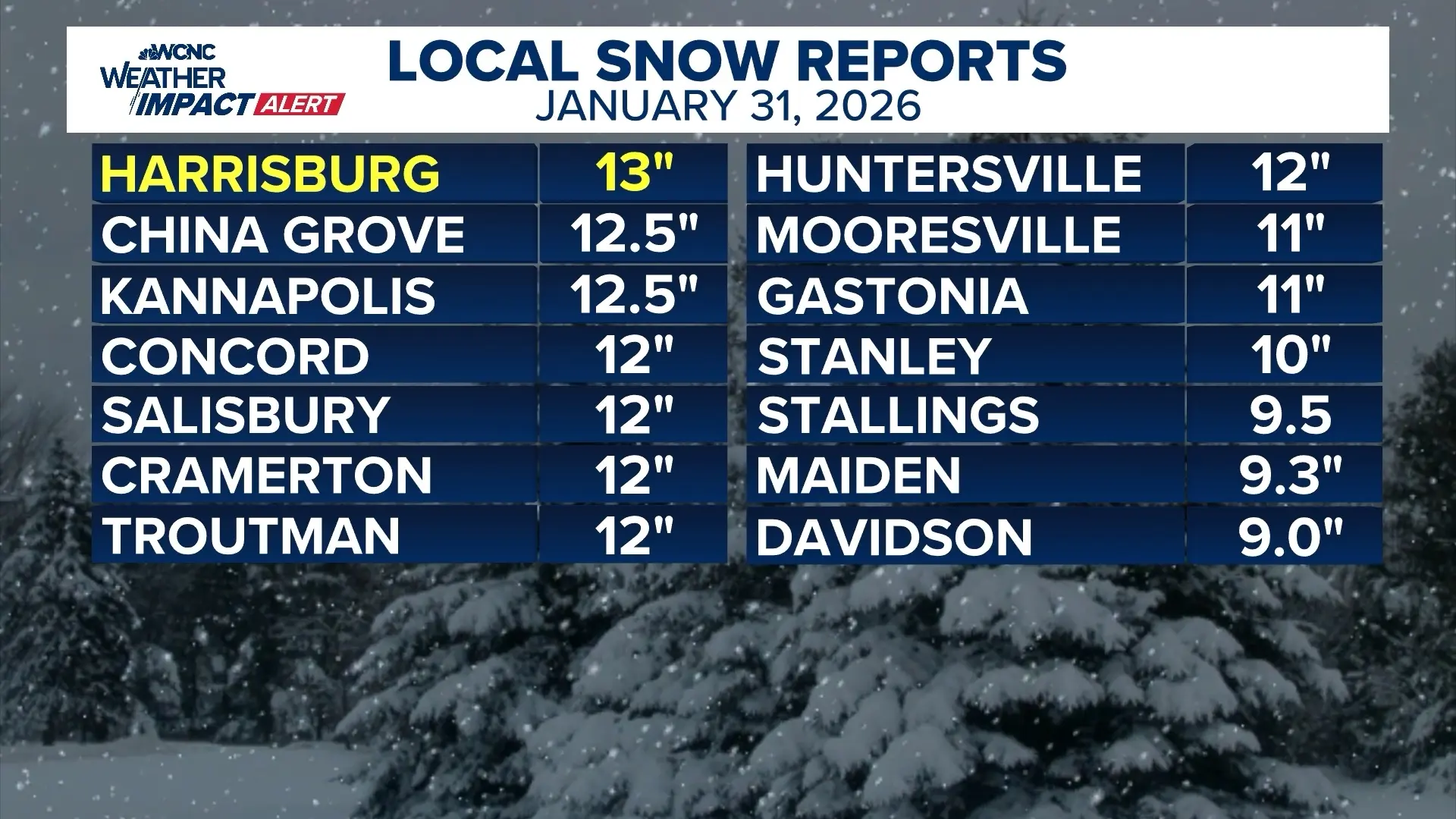
9:39 a.m. – Charlotte Douglas International Airport recorded 11 inches of snow, making yesterday the fourth largest one day snow event in Charlotte history, according to WCNC’s Brad Panovich, tying the 11 inches of snow recorded on Dec. 29, 1880.
9:25 a.m. – Need an interlude from the storm coverage? A boxer got his toupee knocked loose last night during a fight, tossed it into the crowd, and then gave the best post-fight interview since Mike Tyson. (Warning: interview contains one expletive).
9:15 a.m. – Thanks to reader David for the nudge on a roads update this morning. This just in from Assistant Town Manager Tyler Beardsley, who oversees public works.
We were plowing at daylight this morning. Working on main roads then going to neighborhood streets in the late morning or early afternoon.
Got any other questions or tips for us to today? Hit us up at [email protected]
8:55 a.m. – Public officials are asking people to stay home so they can focus on clearing roads, but the reality is that some of you might need something at some point today.
Publix is opening at 10 a.m. but doesn’t plan to operate on a normal schedule. No one answered the phone at the Peninsula Harris Teeter. Food Lion is open now.
The automated phone response at Home Depot says it will open at noon. The “AI assistant” that answered the phone at Lowe’s was unable to respond with today’s store hours.
Bottom line: call ahead before you go.
8:30 a.m. – We’re awaiting an update from public works on today’s plowing plans and will update you as soon as we can, but the original plan was to focus on main roads yesterday and neighborhoods today. Send us an email if you have any roads updates or concerns and we’ll try to help chase down answers.
Saturday, Jan. 31
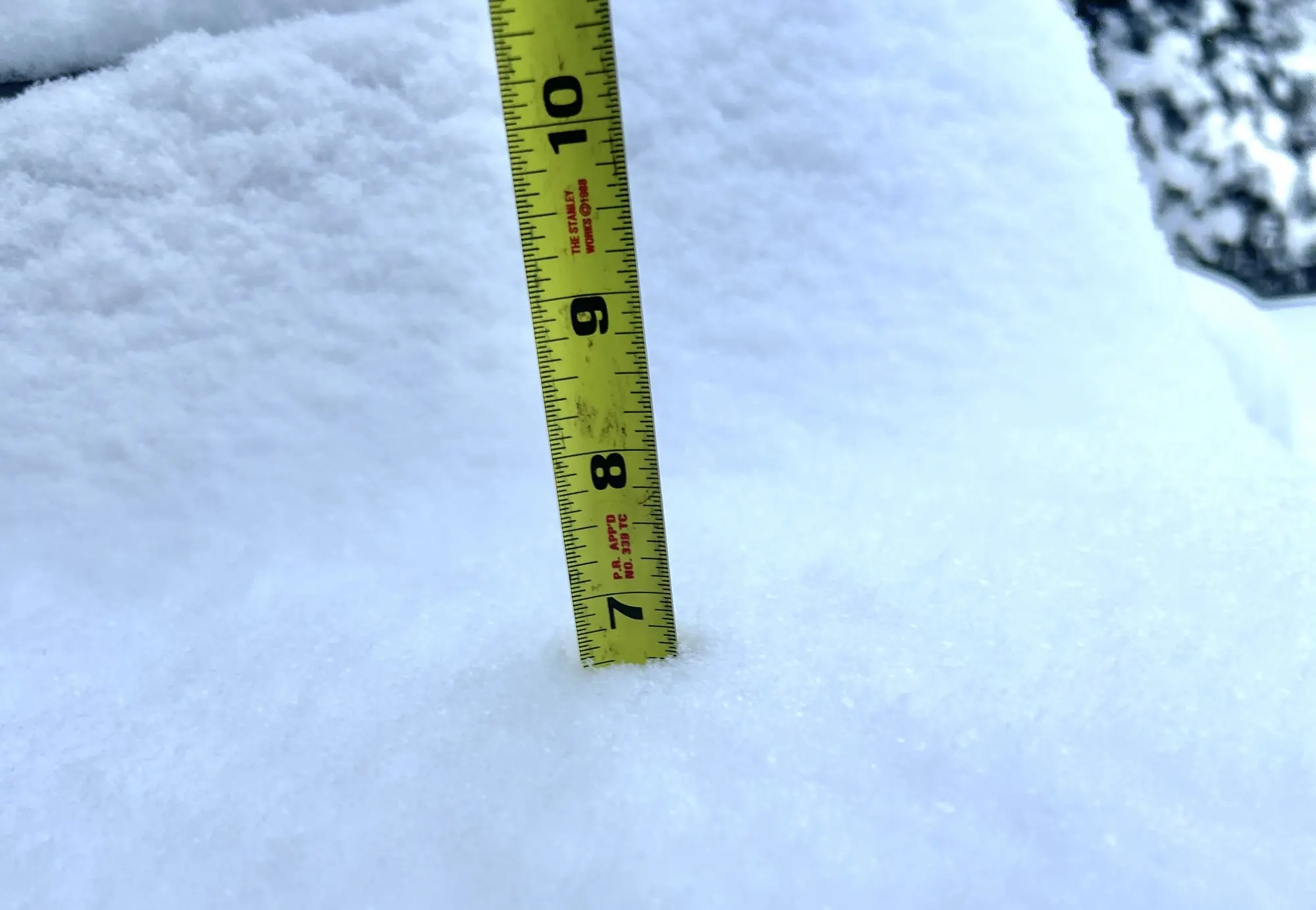
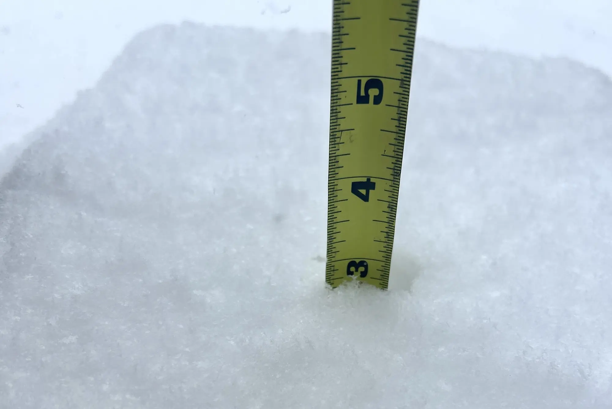
5:23 p.m. – Current snowfall at the Cornelius Today SnOMG’26 Command Center.
 4:26 p.m. – Still snowing. That is all.
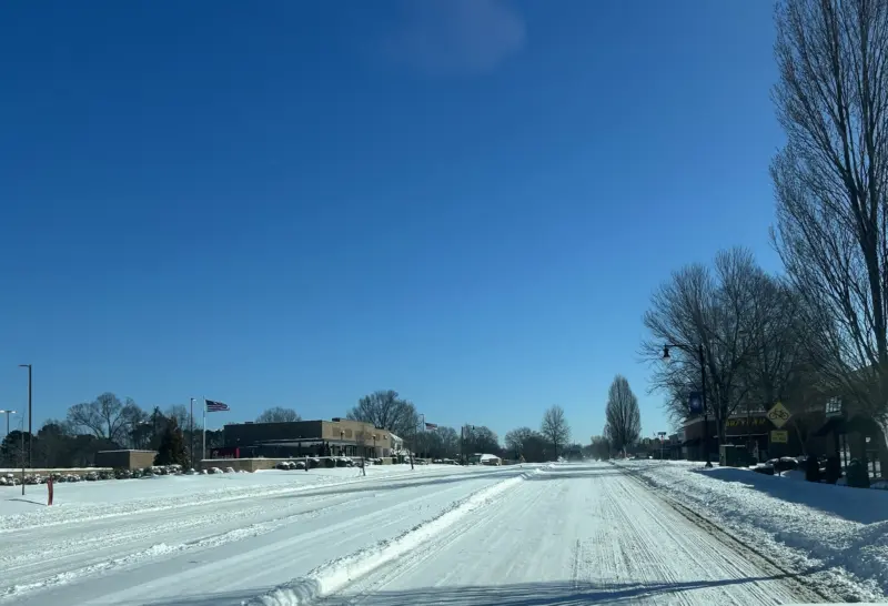
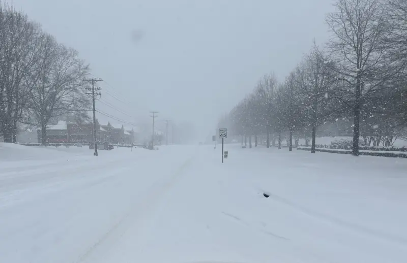
1:45 p.m. – In case you’re wondering why you’re better off staying home—here’s the scene on Independence Boulevard.
1:36 p.m. – Update on the previous post about plows only focusing on main roads today and going into neighborhoods tomorrow. A plow just came through Robbins Park on the southwest side of town, so it looks like they’re ahead of schedule.
1:35 p.m. – There are currently zero power outages with ElectriCities, Energy United, or Duke Energy customers, according to the online reporting maps for each electricity provider.
12:27 p.m. – Roads update—plows are out on main roads but likely won’t get to neighborhoods until tomorrow, according to town officials.
12:00 p.m. — Reposting from the original SnOMG’26 Live Blog last week because, I don’t know, why not?
Here are our top five adults and top five kids movies that take place in the snow. Yes, I believe Frozen II is better than Frozen but that might be because I took my three-year-old son to see Frozen and didn’t know it was a princess flick until ten minutes into the movie. I took the girl to Frozen II—much better overall experience for everyone involved.
Top five (adults)
- Grumpy Old Men
- The Shining
- Alive
- Fargo
- Everest
Top five (children)
- Frozen II
- Ice Age
- Happy Feet
- Frozen
- Snow Dogs
—Jon
11:44 p.m. – It’s been a long time since we’ve had a good snowstorm around these parts, so unfortunately many of you with young children haven’t had the opportunity to learn from the abundance of mistakes that come with trying to keep a kid outside during a snow day. As I currently don’t know the whereabouts of my wife, dog, children, or truck, please allow me to share some of the things I’ve picked up over the years.
- Nothing messes up a snow day like a toddler whose gloves fall off 20 minutes after you walk outside, which means you have to go back inside and watch countless reruns of Yo Gabba Gabba or whatever garbage the kids are watching these days. Bluey? Ugh. Duct tape your kid’s gloves to his or her jacket to ensure you won’t have to spend the rest of the day inside attempting to entertain a kid who doesn’t want to go back outside.
- Failed to buy your snow gear, leaving your kid the only one in the neighborhood who doesn’t have boots? Put them in thick socks, slide on a zip lock bag (not a grocery bag, they rip easily) and tuck their feet into whatever shoes you have laying around. It won’t last forever but it’ll do.
- When they come in starving and thirsty and throw their stuff all over the place, pick it up and toss it in the dryer. Those wet shoes too. You can clean your dryer tomorrow.
—Jon
10:42 a.m – Current snowfall at the Cornelius Today SnOMG’26 Command Center.
9:34 a.m. – An unscientific survey of Instagram is showing many businesses are not opening or closing early today. Suffolk Punch in Birkdale is an outlier, for now, and is opening its doors at 11 a.m.
9:28 a.m. – Due to weather conditions, all CATS services are operating on a Sunday schedule. The Gold Line is suspended. CATS Micro services will be suspended at 11 a.m. today. Due to road conditions, weather detours along bus routes are now active. Visit the link below for a complete list.
Current Weather Delays and Detours
9:08 a.m. – The morning is off to a rough start for any parent of a toddler who is super excited to play in the snow but isn’t old enough to realize that there’s not enough snow out there yet. I finally found an upside to raising teenagers – I’m currently drinking coffee and listening to Cat Stevens on the Victrola.
—Jon
8:21 a.m. – The roads aren’t great but you can still get around, for now. Grocery stores are open but aren’t expected to adhere to normal closing hours.
7:44 a.m. – Checking in this morning with Brad. We’re dropping his last name and job title – at this point he’s just Brad.
I don’t expect the snow to let up till well after dark. Probably nine or 10 o’clock. Be safe out there it’s gonna be cold and windy and roads are gonna be pretty bad so have fun but don’t get too crazy.
Have fun but don’t get too crazy, Brad? Sounds like a dare. We’re not quite where we need to be for a good one but it looks like we’re getting closer.
Snow day!!
—Jon
Friday, Jan 30
4:15 p.m. — Due to the forecasted snow, all Cornelius Parks & Rec activities are cancelled on Saturday and Sunday.
3:30 p.m. — Mecklenburg County and the City of Charlotte Government are declaring a State of Emergency and County facilities will be closed this weekend due to winter weather. The State of Emergency is effective Jan. 30 at 5 p.m.
What that means:
– Price increases are prohibited
– Immediate needs like rescue, medical assistance, food and shelter are addressed
– Essential facilities can be restored for residents and visitors
Additionally, all Mecklenburg County Park and Recreation operations will be closed on Saturday and Sunday. Mecklenburg County Recycling centers will be closed on Saturday.
2:51 p.m. – Update on trash pickup:
Waste Pro is closely monitoring the impending storm. For the safety of our crews and the community, we do not anticipate operating on Saturday, January 31.
Friday Customers Only:To stay ahead of the weather, we are implementing the following service shift for our Friday routes:– Friday collection is canceled for this week and will shift to your next regularly scheduled pickup on Friday, February 6.– To accommodate the shift, we will collect additional bags left outside of your cart for Friday customers only during next week’s pickup.– We appreciate your patience and understanding as we navigate these icy conditions. Please stay safe, stay warm, and keep off the roads if possible
1:41 p.m. – Shoutout to the folks at Visit LKN, who we saw today when we were delivering the February print edition, and discussed some bizarre ideas on clearing snow and ice from your driveway when there’s no ice melt to be found. The verdict: antifreeze doesn’t really work but apparently a mattock (looks like a flat head pick axe) does.
1:10 p.m. — It’s getting real out there. The line at the ABC store was down the aisle and supplies of Tito’s – a bizarre early indicator of holiday and/or storm shopping sprees – was getting thin. On a related note the tacos at the food truck in the Cashion’s parking lot next to the ABC store are delicious.
—Jon
1:03 p.m. – Latest forecast from WCNC chief meteorologist Brad Panovich is below. If you’ve lived in Charlotte long enough, you know a forecast calling for three to eleven inches of snow doesn’t mean the entire metro will see the same thing. One neighborhood can be buried while another barely sees flakes. Just a few years ago, north Mecklenburg picked up four to five inches while south Charlotte saw nothing. A year or two later, it flipped — the Lake Norman kids were home from school even though roads were dry and skies were sunny.
11:15 a.m. – Grocery stores are busier than normal but inventory at the stores I visited late this morning were all restocked after last week’s storm spree. Lines were long at the Peninsula Harris Teeter, where a cashier said it had been busy since opening.
10:21 a.m. – Someone in the comments asked about trash pickup. WastePro is currently planning to collect Friday’s pickups tomorrow due to last weekend’s storm-related delay. That said, plans could change depending on tomorrow’s forecast, so we’ll share any updates as soon as we have them.
10:15 a.m. — Mecklenburg County is expanding homeless shelter capacity between today at 4 p.m. and Monday morning.
Hearts for the Invisible Charlotte Coalition is deploying street outreach teams to homeless encampments to encourage anyone living unsheltered to visit a shelter, and to provide information on how to access shelter and services. Individuals declining shelter will be provided winter weather supplies. Expanded homeless shelter capacity and access is available during this period of extreme weather. Mecklenburg County, its partners, and the shelters will continue to monitor weather conditions and shelter utilization throughout the period.
Men: Roof Above provides shelter for men and expanded capacity at its shelter locations. Men may arrive at Roof Above at 3410 Statesville Avenue in Charlotte beginning at 4 p.m. on Friday.
Women and Families: The Salvation Army provides shelter for women and families with expanded capacity at its shelter location. Women and families may arrive at the shelter at 534 Spratt Street beginning at 4 p.m.
All Neighbors: Roof Above’s Day Services Center at 945 North College Street will operate 8 a.m. to 4 p.m. during this event.
Transportation: Charlotte Area Transit System (CATS) buses will offer rides to these shelter locations during this period. Riders must simply identify a designated shelter location to the driver.
9:45 a.m. – Need suggestions on how to live your best life this weekend? We have thoughts.
—Jon
9:11 a.m. – Road prep update this morning from public works. Brining on roads will continue throughout the day and staff will gather this afternoon to figure out the plowing schedule over the weekend.
8:18 a.m. – In case you need something to read if you’re snowed in, the February print edition of Cornelius Today hits mailboxes today and tomorrow. Check out this month’s stories.
8:03 a.m. – Looking for ice melt? I walked into Lowe’s yesterday and made eye contact with an employee near the door who just shook his head and, before I could get out two words, said, “Ice melt isn’t restocked yet.” Nothing at Home Depot either.
My driveway faces north, so it doesn’t melt for at least a week after a storm, and with the low temperatures it’s still a sheet of ice. So I took his advice and bought antifreeze and poured it all over my driveway, then tracked antifreeze into the house for the rest of the day. The ice is still there.
—Jon
7:42 a.m. — The weather forecast hasn’t changed much over the past few days. Temperatures have been adjusted by a degree or two, but the chance of snow remains. Forecasters have expanded the expected snow footprint across the Carolinas. On Wednesday, WCNC meteorologist Brad Panovich said he expects patchy accumulations, with one town possibly receiving up to 8 inches while another just north or south could see only 1 inch. Speaking of Panovich, he has a breakdown of annual snow totals over the last decade plus.
Thursday, Jan. 29
2:00 p.m. – There are two active warnings from the National Weather Service
Winter Storm Watch
Heavy snow is possible, with 4 to 7 inches expected and wind gusts up to 35 mph. The watch includes northeast Georgia, the Piedmont and western North Carolina, and Upstate South Carolina. Snow is expected to quickly stick to roads due to temperatures in the 20s, with travel conditions deteriorating as early as Friday evening. Impacts may include impassable roads, isolated power outages, and poor visibility from blowing snow.
Extreme Cold Watch
An Extreme Cold Watch is in effect from Saturday evening through Sunday morning. Dangerously cold wind chills could drop as low as 7 below zero across northeast Georgia, the Piedmont and western North Carolina, and Upstate South Carolina. These conditions could lead to hypothermia or frostbite for anyone outdoors without proper precautions.
8:00 a.m. – The town has begun prepping roads as the likelihood of a winter storm increases. Did you notice how quick the roads were cleared this week? There’s a good reason for that.
2 Comments
Comments are closed.
Our Partners


But what is happening with garbage pickup. A Cornelius Today article says that there is a 1 day delay. This would mean that the normal Friday pickup would be on Saturday. But I highly doubt that will happen. The Cornelius website is quiet on the matter. What is happening. Cornelius should do better on the communications.
Friday pickup is on Saturday but may be delayed again due to weather.